Why PurVIEW:
1. Seamlessly Integrated
2. No CAD, no translation, no retrograde
3. Geodatabase-direct editing/mapping
|
 Accuracy Accuracy
monitor dot pitch x view scale.
|
- In Virtual-Z mode:
Depends on DEM Z accuracy,
e.g., IfSAR RADAR DEM at ±1m.
- In manual mode:
X/Y accuracy x f/b ratio.
Camera lens focal length (f) to image base (b) ratio is identical to the flying height (H) to air base (B) ratio and ideally as small as possible.
For example:
If a 152mm lens is used and the
X/Y accuracy is 0.6m, then
Z accuracy = 0.6m x 1.65 = 1m.
|
Source Data Specifications
Information on Ground Sampling Distance (GSD), DEM, scale and mapping accuracy.
|
|
 |
 |
|
| |
 |
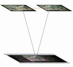
23 x 23cm survey cameras.
Image base is 92mm at 60%
forward overlap, with standard
lens focal length of 152mm:
f/b = 1.65
|

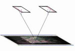
New digital frame cameras:
The two available smaller
image formats result in f/b ratio
of 3.13 and 3.70, less than
ideal without Virtual-Z.
|
Digital aerial scanners:
A combined forward/backward
looking angle of 42 ° results in a
f/b equivalence of ~1.3 with
better Z accuracy.
|
|
|